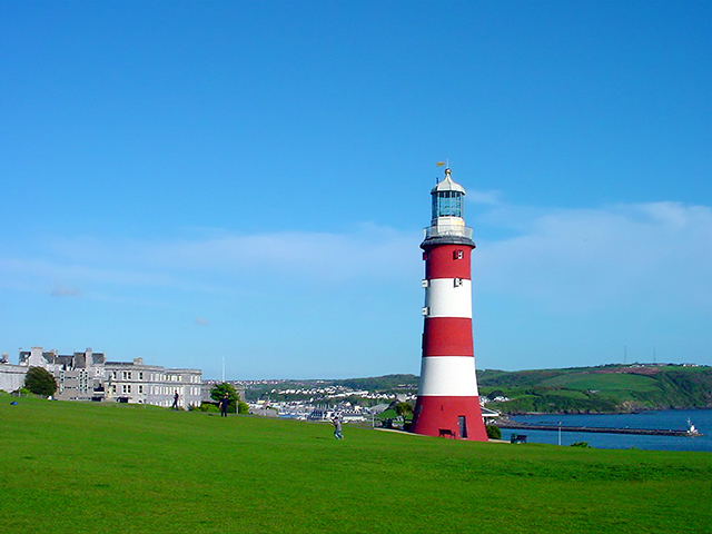
Here’s a page full of pictures that attempts to capture the quintessential nature of Plymouth today. Enjoy 😊
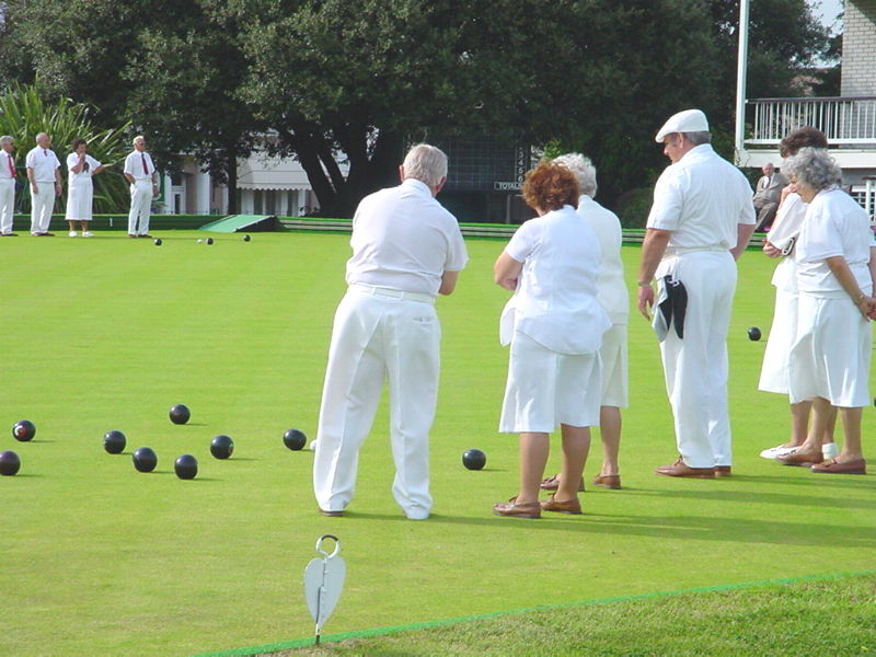
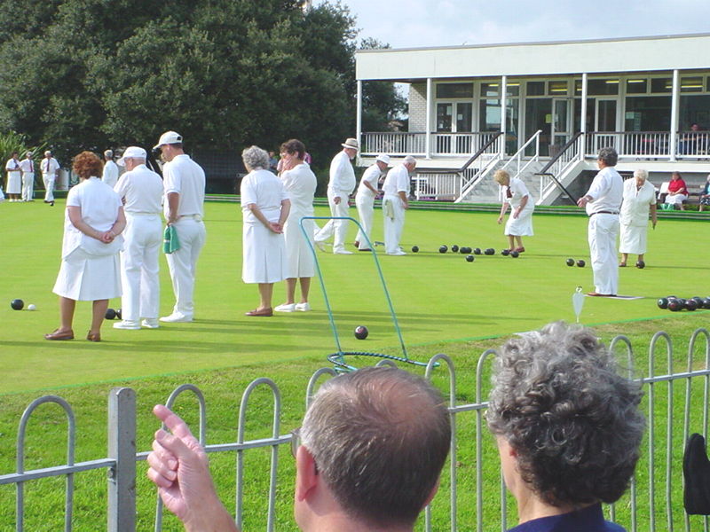
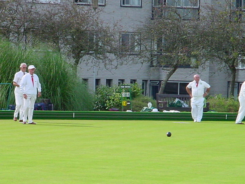
The gentle art of bowls is played today where Sir Francis Drake once played. Famously, after being told the attacking Spanish Armada had been sighted, he calmly finished his game before going to do battle.
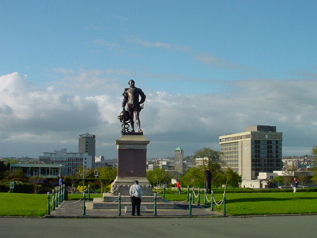
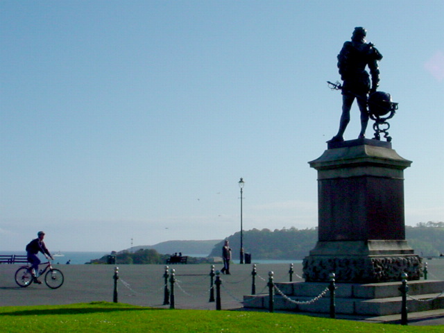
Statue of Sir Francis Drake

If you were watching the bowls (above) from the same viewpoint as the photographer, the statue would be a couple of hundred metres behind you.
Plymouth Hoe
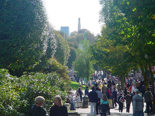
From left to right we have a view of the approach to the Hoe from Plymouth City Centre, and the reverse view, from the Hoe back towards the city centre (with Sir Francis Drake looking pretty dapper).
Below is the view from behind the statue and, turning to the east, you can see Smeatons Tower and Jennycliffs in the distance.
Photo tour of The Barbican, Sutton Harbour and the Hoe

The photo tour starts at North Quay and follows the coast round the Barbican and up
past the Citadel. It continues to the Hoe and then onto West Hoe.
Generally photos are taken of what’s up ahead but occasionally, where it
helps, photos are taken looking back the way we have come.

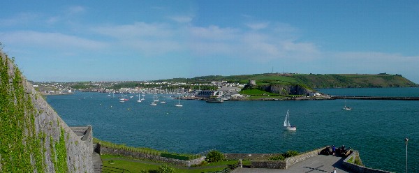
So here’s the starting point, a view from North Quay across Sutton Marina. Jennycliffs can be seen in the distance on the left and the headland that marks the eastern edge of the Citadel, on the right. In front of that is Sutton Jetty.
Around the harbour past Sutton Jetty is the Three Crowns Pub, next to the old Customs House.
This view is taken from the steps of the old Custom House looking across Sutton Pool towards Cap’n Jaspers and the Navy pub
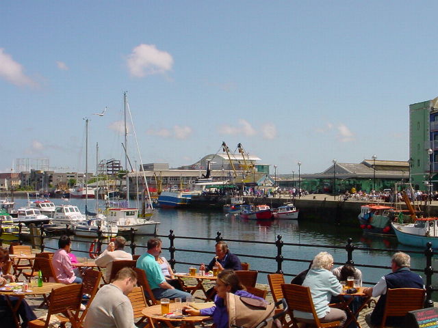
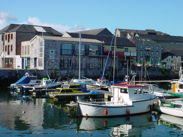
Walking round towards the Navy pub, looking back and to the right of the Three Crowns. The building on the left is the Barbican Antiques Centre – well worth a browse…
Approaching the Navy pub with Cap’n Jaspers dead ahead matey, and Barbican Glassworks to the right


..and turning right, the Barbican Glassworks and the Navy form a gateway into the Barbican proper.
The fish quay is on the left behind and extending past the glassworks…
taken from the Barbican Fish Quay looking across Sutton Harbour to North Quay where we started. Beaumont Park and the spires of St Judes and St Johns churches are in the distance.
You can see that the fish quay is still used by the local fishing fleet. All the restaurants, cafes and, yes, even the local fish and chips shop, all have the freshest produce possible!
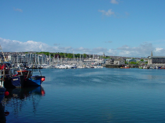

Here’s a close up of the Prawn – you can see it’s a bit like a mixture of a cod, a crab and other fishy-type creatures…
Taken at low tide from the other side of the harbour, you can see the tour ferry waiting for passengers at the Mayflower Steps. Behind and to its right is the new Mayflower Centre (the Prawn is dead centre in front) – now re-opened.
It tells the story of the historic past of Plymouth Harbour and uses multimedia interactive displays to great effect.
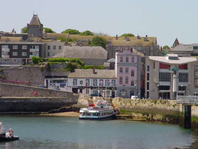
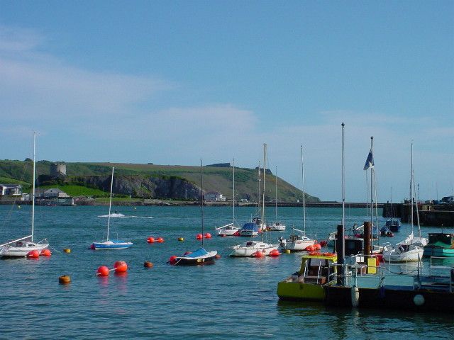
…continuing the walk around the Barbican, this is a view from the Mayflower Steps looking towards Jennycliffs. It’s about the same view the Pilgrim Fathers would have seen as they set sail on their voyage to New England.
The Hoe is around the coast to the right.
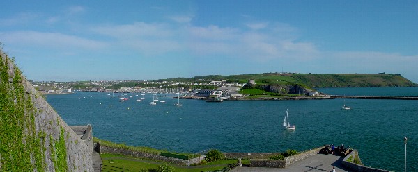
This photo shows the view from the middle section of the seafront between the Barbican and the Hoe. The wall at the left is one of the buttresses of the Citadel, which towers behind and above. It’s a commanding view of the whole of the entrance to Plymouth Harbour and into Sutton Harbour.
it pretty much corresponds to the right hand half of the b&w wide picture above.
..and swinging round to the right, the road continues
up towards the Hoe, passing the Royal
Plymouth Corinthian Yacht Club.
Drake’s Island is in the middle distance, with
Mount Edgecombe behind it.
Round the corner is the final approach to the Hoe proper (next photo)..
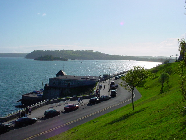
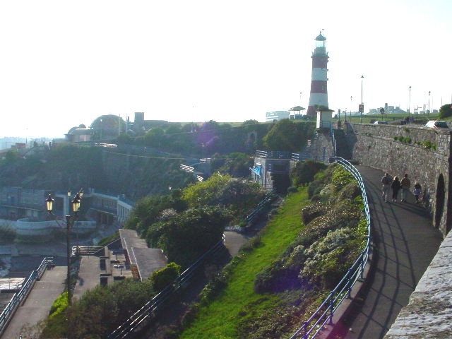
Here’s the seafront path leading up from the rocks at the sea’s edge to the Hoe, weaving its way in and around the various sunning and picnicing areas.
(The Citadel is to the right)
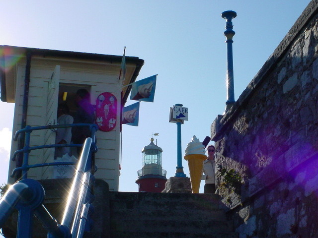
Any visitor will remember the ice cream kiosk at the top of the steps – with Smeatons Tower peeking through
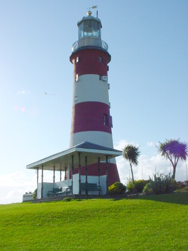
Smeatons Tower taken from beside the ice cream kiosk
The lighthouse keeper of the wooden one which this replaced (Rudyerd’s Tower) has a real claim to fame. His was the first official autopsy … He claimed that when the lighthouse first caught fire, he had looked up to see what was happening. As he looked up, a glob of lead that had melted from the roof went right down his throat. No-one believed him. When he died a few days later, they opened him up and found… the glob of lead!
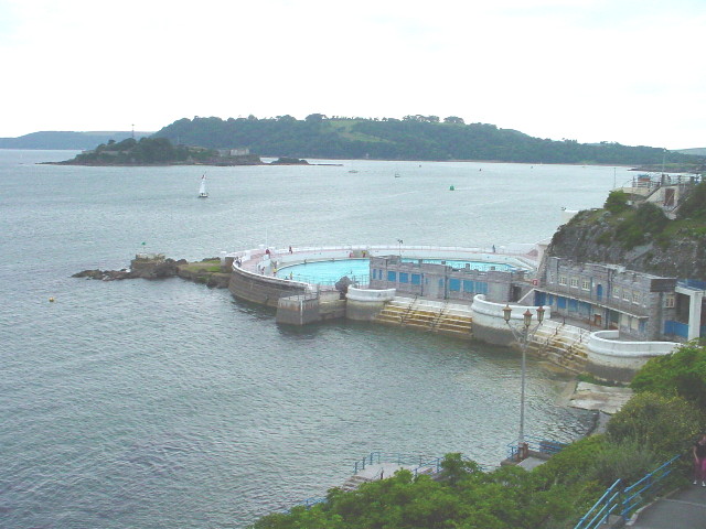
Continuing the walk round the sea front… Plymouth’s world-famous art-deco Lido is completely refurbished. It’s even better now than it used to be!
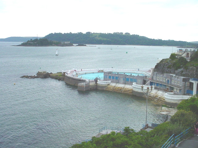
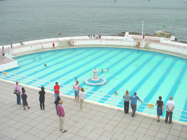
It wasn’t the warmest of days when these pictures were taken but there were a few brave souls enjoying a swim.
A close-up of the main fountain – anyone who remembers how it used to be will probably have happy memories of taking turns to sit atop and splash everyone else in the queue…. 🙂


Looking back towards Smeatons Tower from above the Lido… it’s a beautiful backdrop to the Hoe experience.
Turning again to continue, facing West Hoe with the Waterfront restaurant in the distance. The tidal swimming pool in the foreground is a popular spot for older children, mums and dads.

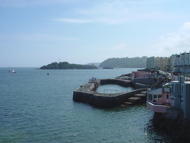
The harbour on West Hoe is sandwiched between the Wet Wok and Waterfront restaurants.
It’s a popular spot for fishing and with a bar / restaurant close to hand… 🙂
Drake’s island lies in the middle distance and Mount Edgecombe and Cornwall beyond that.
Taken from the Waterfront restaurant, after a splendid meal on Mother’s Day 2003 (yep, that’s my mum!). We have a huge naval tradition in the family and my dad when he was alive used to skipper a merchant ship. Plymouth was one of its major ports of call and my mum was reminiscing…

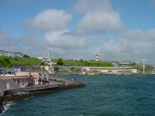
Looking back along the Hoe from West Hoe. The view takes in the seafront from the Waterfront to the Lido.
On the skyline, the war memorial and the red and white of Smeatons Tower make obvious landmarks.

